Textomap

About Textomap
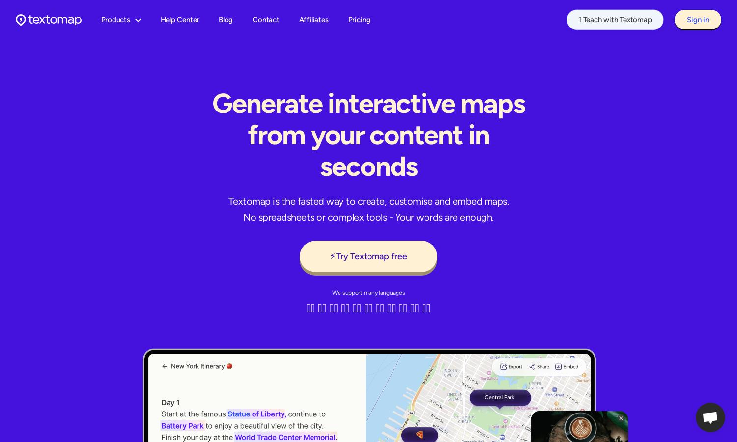
Textomap is an innovative platform designed to help users create interactive maps effortlessly from text. Ideal for educators, content creators, and travelers, it streamlines the mapping process by allowing users to generate maps from text sources or CSV files. With AI integration, Textomap enhances visual storytelling and data representation.
Textomap offers various pricing plans, including a free tier with essential features, enabling users to start creating maps immediately. For those seeking advanced functionalities, upgrading unlocks unlimited maps, CSV uploads, and additional support, ensuring that users can maximize their mapping potential with ease.
The user interface of Textomap is designed for seamless navigation, with intuitive menu options and simple drag-and-drop features that enhance usability. Clear visuals and responsive design ensure users can access their maps easily, making Textomap a preferred choice for novice and experienced mappers alike.
How Textomap works
Users start by signing up for Textomap, then simply input text or upload a CSV file containing location data. The platform scans the text for relevant places, allowing users to add pins, customize labels, and link additional content. Interactive maps can then be easily shared, embedded, or exported, making the entire mapping process straightforward and efficient.
Key Features for Textomap
AI-Powered Map Creation
Textomap leverages AI technology to facilitate quick and efficient map creation from textual inputs. This innovative feature streamlines the user experience, allowing for immediate visualization of location-based content, enhancing creativity, and saving time in the mapping process.
CSV Map Generation
With Textomap, users can upload CSV files to generate maps quickly and accurately. This feature allows for the mass import of locations, making it perfect for users with extensive data sets who want to visualize large amounts of information effectively.
Seamless Embedding
Textomap enables users to effortlessly embed interactive maps into their websites or blogs with a simple copy-paste code. This functionality enhances content engagement and offers a visually appealing way to present geographical data, making it an essential tool for content creators.
You may also like:


