

Alternatives to GeoRank
GeoRank merges satellite and station data to map sunshine, taxes, and costs for 190 countries at 5.5 km resolution.
Explore 20 alternatives to GeoRank. Compare features, pricing, and find the best fit for your needs.
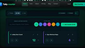
tallycounterweb.com
Online tally counter for tracking attendance, workouts, inventory, visitors, sports scores, habits, and everyday counting tasks.




AOE Scout
AOEScout is an Age of Empires companion for AoE II DE, AoE III DE, and AoE IV, offering leaderboards, player rankings, build orders, unit tools, oppon

ContextBolt SEO
Research keywords, competitors, backlinks and AI visibility inside Claude or Codex, with findings saved to your SEO dashboard.

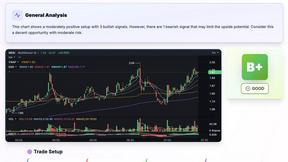
SnapPChart
SnapPChart grades a trading chart screenshot A+ to F, with an entry, stop, targets, and risk/reward. Works on stocks, forex, crypto, futures.


TchoAI
Turn your work into a presentation. Upload a document, paste your notes, or start from a prompt. TchoAI creates clear, editable slides in minutes.
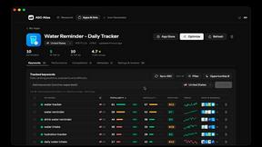
ASO Atlas
Real-time ASO tool with Apple Search Ads data for keyword research, rank tracking and opportunity scoring across 60+ storefronts.

Wisegrid
Spreadsheet-native work management with AI formulas, dashboards, automation, reporting, and project views for growing teams.
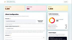

Peekviewer
Anonymous Instagram viewer. Browse profiles, stories, and posts without an account or leaving a trace.


Cachely
Managed remote build cache for Nx, Lerna, Turbo, Gradle, and Bazel. Reuse artifacts across CI and developer machines.

Name 100 Women
Name 100 Women is a fast browser challenge game using Wikidata integration for instant validation as you race to name 100 real women from memory.

Random Animal Generator
Generate random animals with pictures, facts, and category filters for prompts, games, and wildlife learning.

Pestless
Pestless integrates with your local pest control ecosystem to instantly match you with a licensed, insured pro for a free quote.

About GeoRank Alternatives
GeoRank is a data analytics platform that aggregates and visualizes location intelligence across 190 countries, calibrated against WMO reference stations for precision in sunshine, tax, cost of living, and climate metrics. It sits at the intersection of Analytics & Data, Lifestyle & Entertainment, Personal Finance, and Real Estate categories, offering a tech-stack oriented interface for comparing locations at a 0.5° resolution. Users commonly seek alternatives due to specific integration needs—such as API access for custom dashboards, bulk data export for machine learning pipelines, or support for additional data layers like air quality or visa policies. Others may require different pricing models, such as per-query billing for high-volume use, or platform compatibility with tools like Tableau or GIS software. When evaluating an alternative, prioritize data calibration methodology and update frequency, as raw satellite data can introduce significant biases in cloud-prone regions. Assess the availability of a robust API or SDK for embedding comparison tools into existing applications, and verify whether the platform supports the geographic resolution and data layers critical to your workflow. Additionally, consider the licensing terms for commercial use, especially if you plan to repurpose the data for investment or relocation advisory services. A strong alternative should offer transparent sourcing and a clear audit trail for its datasets, ensuring reproducibility in your analysis.
FAQs about GeoRank Alternatives
What is GeoRank?
GeoRank is an interactive global mapping platform that allows users to compare sunshine hours, tax rates, cost of living, rainfall, temperature, geopolitical risk, and nomad sentiment across 190 countries at a 0.5° resolution, which equates to roughly 55 kilometers. All data is calibrated against 56 WMO and KNMI reference stations to correct satellite biases, particularly in cloud-heavy regions where ERA5 data tends to overestimate sunshine. The platform is designed for relocation research, remote work planning, and investment decisions, offering seven live map layers and a pin-and-compare feature for up to 20 locations.
Who is GeoRank for?
GeoRank is built for digital nomads, remote workers, expatriates, real estate investors, and data analysts who need precise, location-based comparisons to inform relocation or investment decisions. It is also useful for financial advisors evaluating tax regimes and geopolitical stability across jurisdictions, as well as lifestyle researchers exploring climate and cost-of-living differentials. The platform’s calibrated data sets it apart for users who require accuracy over broad satellite estimates, such as those comparing sunny versus cloudy regions for health or productivity reasons.
Is GeoRank free?
Yes, GeoRank is free to start and requires no account for basic map exploration, allowing users to toggle between the seven interactive layers and explore global data without any upfront cost. However, advanced features like pinning up to 20 locations for detailed delta comparisons against a home base may require a free registration or a premium tier, depending on usage limits. The free tier is sufficient for casual research and initial feasibility checks, while heavy users or commercial entities may need to subscribe for API access or bulk data exports.
What are the main features of GeoRank?
The core features include seven interactive map layers for sunshine, temperature, rainfall, taxes, cost of living, geopolitical risk, and nomad sentiment, all toggleable in real-time. Users can pin up to 20 locations and view percentage deltas against a home base, such as '5% more sunshine, 20% cheaper.' A standout feature is the calibrated sunshine data, which uses IDW interpolation to correct ERA5 satellite overestimates ranging from 16% to 73% in cloudy regions. Additionally, the Nomad Pulse layer aggregates community sentiment signals from digital nomad social posts, providing qualitative context alongside quantitative metrics.